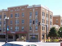
On Wednesday, February 2, 2022 at 12 noon the exhibition “Maps 1857 to 1913” will open at the Landmark Center, Kansas Avenue at Third Street, in Liberal, Kansas.
The exhibition, presented by Landmark Center owner Todd Stanton, features a number of historic maps of our region. The earliest dates from 1857 and shows the Kansas Territory as it then stood encompassing Denver, Colorado Springs and Pikes Peak all which are today in the State of Colorado. Stanton noted, “not only have our borders changed, so has our spelling from the frequently seen Kanzas to the spelling of today as Kansas.”
Stanton relates that he has three favorites in the exhibition. One on loan from local historian Lidia Gray is a Kansas road map dating from 1913-1918 where route names are far more colorful and descriptive than “US Highway 54,” which did not yet exist. Another comes from the 1859 publication entitled “Guide to the Kansas Gold Mines” which may seem an odd title until you realize Kansas then encompassed much of Colorado. The third favorite is known as the Oklahoma alphabet map which dates to 1893. At that time, the Organic Act was only three years old with boundaries and names changing with considerable frequency. A number of the counties are simply designated by a letter of the alphabet. Whether that decision on naming was made by the Territorial administration or the map makers frustrated by continual changes that rendered any number of atlases obsolete is unclear.
The earliest known maps date to the 6th and 5th centuries BC and were based on the flat earth concept. Who or what was actually inhabiting the Great Plains of North America at that time is educated conjecture. By the Hellenistic period (323-31 BC), the idea of a round earth had already taken shape (but was debated for centuries) and a general idea of the size of the earth was known allowing better and proportional maps.
16th Century explorers of our general region included some, such as Cabeza de Vaca, who were simply lost. Some made crude maps based on observations while others simply left written descriptions which later readers have attempted to place on maps. Later on, scouts for various enterprises created better maps. By the time of the maps presented in this exhibit, cartography had evolved into a skilled endeavor based on science and observation.
So, put down your cell phone with map programs that have you take left turns where they don’t exist and head over to the Landmark Center on February 2 to see some wonderful real maps from our history.
Photographs from the Ghost Towns of Seward County and Kansas Avenue 1888-1930 exhibits remain on display.